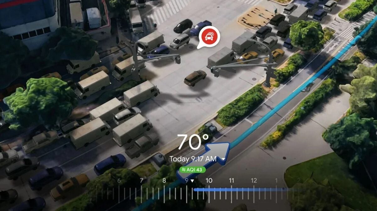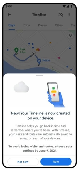
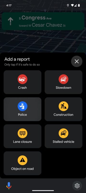
In its day, Google Maps decided to integrate the incident reporting system from Waze, another navigation app that also belongs to Google. With this feature, users can create incidents that will appear on the map for other users to see, including roadworks or accidents, among others. Now, the company has introduced a change that affects how police checks are reported, removing what was probably the favorite feature of many drivers: mobile speed cameras.
Instead of reporting speed cameras, Google has introduced a more generic label to mark police presence. With this change, Google Maps would cover different situations where police officers are on the road, such as directing traffic or responding to emergencies, situations that did not fit the old speed camera system. Although this might disappoint those who used this option, the new feature still allows reporting areas where there are speed checks, albeit in a less specific way.
According to Android Police, the “police” label now appears prominently in the list of incidents that drivers can report. The new functionality will be available in all versions of the app, including Android, iOS, Android Auto, and CarPlay, although its availability may vary by region.
Although many drivers may not like it, the change could be very beneficial for road safety. The uncertainty about the purpose of the police presence could motivate drivers to be more cautious, reducing speed in designated areas, regardless of whether it is a radar or officers in another type of intervention.
The new change is included in version 24.47.04.699095382 of Google Maps. If you still don’t see the police label, it is likely still being rolled out in your region and may take a few days or even weeks to become available.