In the envelope that Antal had between his fingers, one could read a note that read “The solution will give you the exact reasons for my suicide and also the names of the people concerned.”
March 3, 1926. A man enters Café Emke in Budapest, orders something, and tries to make several phone calls. An hour later, unable to find the person he was looking for, he enters the bathroom and shoots himself in the chest, and to ensure his death, in the head. It wasn’t something so incredible in Hungary at that time, which, in fact, earned the nickname “city of suicides.” But this had something special: an envelope between the dead man’s fingers that to this day remains unsolved.
When the police arrived at the scene, they could identify him: it was Gyula Antal, a waiter who had been living in poverty for a while and had just been evicted from his home due to inability to pay rent. To pay off his debts, in fact, he had left behind all his clothes. The motive for what he did seems obvious, right? Well, there’s a piece of the puzzle you don’t know. Or rather, the crossword.
On the envelope that Antal had between his fingers, there was a note that read, “The solution will give you the exact reasons for my suicide and also the names of the interested parties.” Inside was an unfilled crossword puzzle that the police started to complete but stopped because they found it “too complicated.” It sounds like the beginning of a good detective novel, but the story isn’t quite that thrilling and ends here.
It’s important to consider that in the 1920s, there was a whole craze for crossword puzzles, much like there might be for video games or Marvel movies today. Just as newspapers now predict the decline of crosswords in the years ahead, people back then viewed crosswords as the most modern thing in the world. To some extent, they were.
As we approach the hundredth anniversary of Antal’s death, and knowing that the story is true and not an urban legend thanks to newspapers from that era, we’re left with questions: Will we ever get to see the unsolved crossword? Did the police throw it away? Why aren’t there five or six writers right now crafting a story about a detective who has never been seen in one of these? Questions upon questions. Hopefully, someday we’ll have the answers.
The thawing of the permafrost can be a great threat to humanity, and not only due to the rise in sea level or climate changes.
Imagine this: an ancient virus awakens after thousands of years and triggers a global pandemic. Sounds like a Hollywood movie, doesn’t it? But what if we told you that this is more than fiction; it’s a real possibility that we could be exposed to due to climate change?
A new study published in the journal PLOS Computational Biology raises alarms about the ecological and health risks of “time-traveling” pathogens that could be released due to the thawing of permafrost, a layer of frozen soil found in polar and mountainous regions of the planet.
The uniqueness of this frozen layer is that it perfectly preserves the organic remains of animals and plants that inhabited the Earth long ago, as well as microorganisms that have been inactive for thousands or even millions of years. However, rising temperatures are causing the permafrost to melt and release these dormant microorganisms.
In order to assess the threats we could potentially face, an international team of researchers conducted a computer simulation where they introduced virtual viruses from the past into present-day bacterial communities.
The results are quite surprising: 3% of the ancient viruses managed to survive and evolve in the modern environment, and some of them even caused significant changes in bacterial diversity.
Specifically, 1% of the ancient viruses had unpredictable effects: some increased bacterial diversity by up to 12%, while others decreased it by up to 32%. These invading viruses not only adapted to the current conditions but also disrupted the ecological balance.
While this is a simulation, the authors of the study warn that these scenarios could occur in reality with actual pathogens. The researchers acknowledge that it’s difficult to estimate the risk of an ancient pathogen causing a serious or contagious disease in humans, but they do not rule it out.
Some of the links added in the article are part of affiliate campaigns and may represent benefits for Softonic.
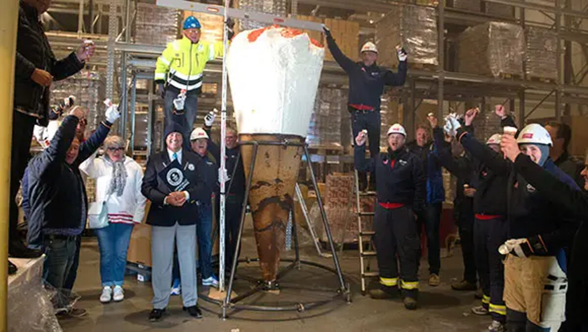
In 2015, Henning-Olsen, a family ice cream company, managed to create an ice cream 3.08 meters high and weighing more than a ton, caused by the 1080 liters of ice cream that they had to put inside a 95 kilo cone.
There are people who spend entire summers without gobbling ice cream at all hours. No, I don’t know how they do it either. A good ice cream is one of the few things capable of curing all the ills of the world, a balm for bad feelings. So from time to time you have to ask yourself, what if you could have an ice cream that would last a lifetime? Well, not exactly, but in Norway they came close to achieving it.
In 2015, Henning-Olsen, a family-owned ice cream company, managed to create an ice cream 3.08 meters tall and weighing more than a ton, caused by the 1080 liters of ice cream they had to put inside a 95-kilogram cone. In fact, the thing was so big that they had to take it by helicopter to Kristiansand, the place where the world record was verified.
The best part is that the ice cream fed 10800 people, at two scoops per person. In other words, an ice cream that had 21600 scoops inside. That’s almost nothing. Of course, the heaviest ice cream in the world was a huge sundae that was assembled in Edmonton (United States): almost 25 tons in a gigantic pool in which we would not mind taking a dip in the middle of August.
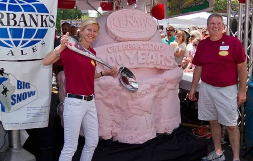
Also from the United States is the record for the longest ice cream: more than a kilometer (exactly 1386 meters) for 4000 people in Texas who helped to make it and consume it in less time than you think: half an hour. Ah! And if we take away the cone and just look at the ball itself, the heaviest in the world also comes from America, this time in Wisconsin. 1365 kilos of strawberry ice cream, which was handed out for free in the following days.
In this delicious walk through the most impossible things on the planet we did not want to leave you without scratching your wallet. Do you think that every time you buy a Magnum they are more and more expensive? Well, wait until you find out how much the invention costs in a place in Shibuya (in Tokyo) where a ball of white truffle, natural cheese and gold can cost you 6211 euros. So much so that it melts in no time at all… didn’t we leave you… frozen?
A group of scientists has discovered a new and mysterious marine creature in the depths of the ocean, near Antarctica.
Earth continues to conceal significant secrets within its depths. With areas that can exceed depths of 10 kilometers, which greatly complicates human access, the oceans are like small “alien worlds,” brimming with mysteries and entirely unfamiliar creatures.
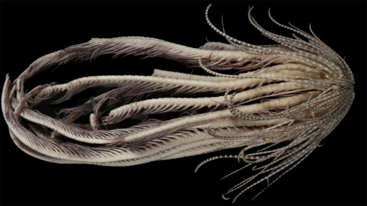
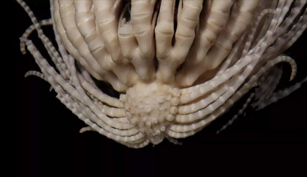
A few days ago, Business Insider reported the discovery of a new creature found in the depths of the sea. Located between 66 and 1170 meters beneath the ocean’s surface near Antarctica, this “sea monster” possesses 20 tentacle-like limbs covered in a feather-like material resembling bird feathers.
The newly discovered creature, which also features a set of small claws that help it grip the seabed, has been named the “strawberry squid star.” This distinctive name was coined by Greg Rouse, a marine biology professor and co-author of the study detailing the discovery of this new species, published in Invertebrate Systematics.
And, although it might seem like a rather random name, it does make sense. If you remove the small tentacular threads that the creature has, which emerge from its base (cirri), you can see that its shape is very similar to that of a strawberry. “We removed a lot of cirri so that you can see the parts to which they are attached, and that’s what looks like a strawberry,” Rouse explained.
The marine biologist also observed that the longer, feathery parts of the strawberry squid star (certainly not the shortest name for an animal) tend to extend and assist in the movement of this inhabitant of the deep sea.
Of course, the species also has an official name: Promachocrinus fragarius. “Fragarius” is derived from the Latin word “fragum,” which means strawberry. The creature belongs to the family of crinoids, which includes starfish, sea urchins, and sea cucumbers.
What kind of marine creatures are yet to be discovered in the depths of the sea?
Some of the links added in the article are part of affiliate campaigns and may represent benefits for Softonic.
After dying (due to a recipe based on jade and mercury, which for whatever reason suited him well) he was buried in a tomb of which absolutely no manuscript of its construction has been preserved. And therein lies the problem.
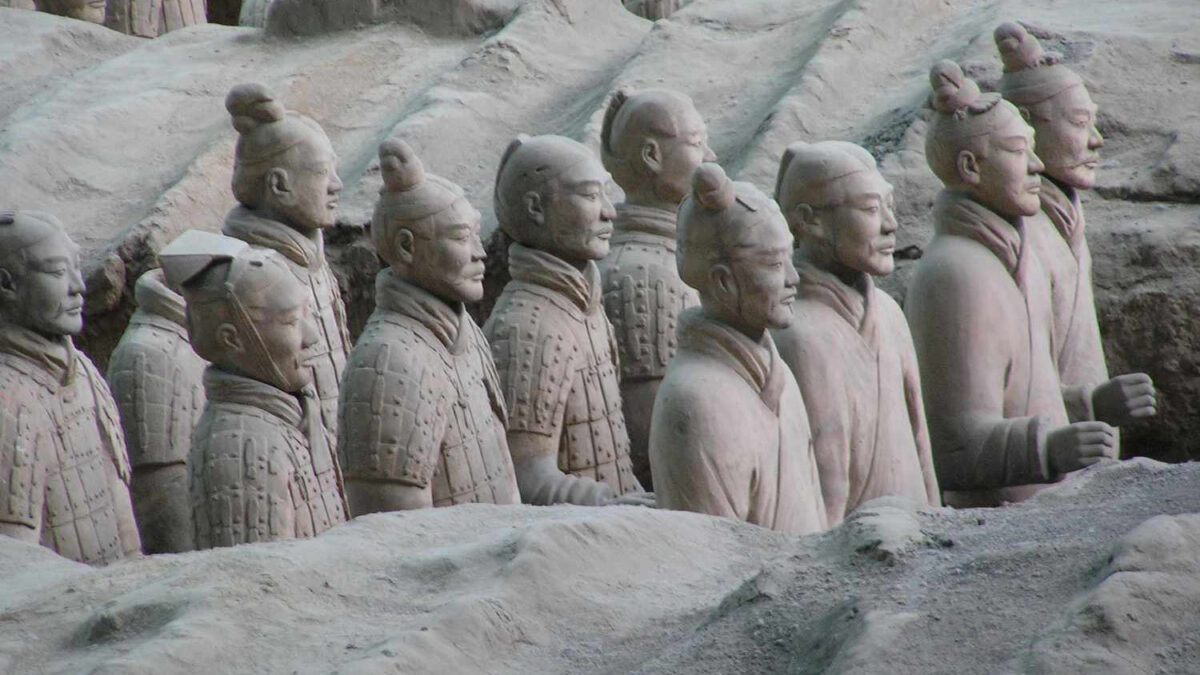
Year 221 B.C. Qin Shi Huang, then king of the Qin region in China, became the emperor of a united country for the first time in its history. He was a tyrant who burned books and beat intellectuals, but it is no less true that under his rule the Terracotta warriors were created and even the Great Wall of China began to be built. After his death (due to a recipe based on jade and mercury, which, for whatever reason, was not good for him) he was buried in a tomb of which absolutely no manuscript of its construction is preserved. And therein lies the problem.
Year 1974. A group of Chinese farmers manage to find the tomb of Qin Shi Huang… but archaeologists, fifty years later, keep it closed. And there is a reason for that: it is sensed that inside there may be all kinds of surprise traps, as if it were a video game but deadly real, from spears falling from the ceiling to mercury for anyone who dares to disturb his eternal sleep. Rich people now have giant dogs, but mercury is much scarier than any bite.
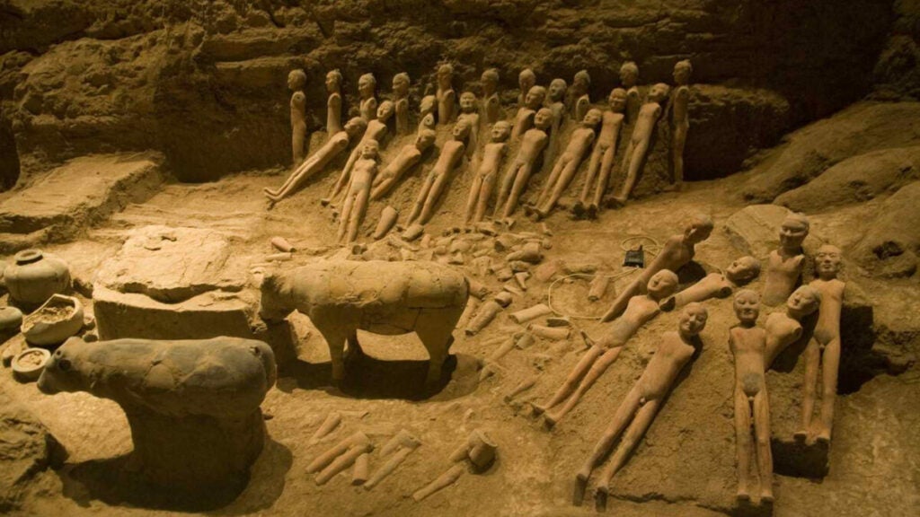
The necropolis has been thoroughly investigated (the famous terracotta warriors were found there), but opening the tomb is another matter: no one knows what can be found inside. In fact, a century after the death of the emperor it was written “Artisans were ordered to make arrows and spears intended to shoot anyone who entered the tomb. Mercury was used to simulate the hundred rivers, the Yangtze, the Yellow River and the great sea, and prepared to be set in motion mechanically.”
The problem is not so much that of being able to die (for something there are suits prepared for the purpose of not doing so), but that the excavation can damage the tomb and lose very important historical information: right now there is no way to enter that is not invasive and with great risk of causing a collapse. After all, it was mistakes of this kind, caused by haste and the desire to do everything in a hurry, which caused the definitive end of the city of Troy, which sank in 1870 and of which little has been rescued.
There is probably little left to find a solution and see what the emperor has so carefully stored there. Or maybe that’s not such a good idea. I mean… We’ve all seen ‘The Mummy‘, right?
A group of researchers from the Schmidt Ocean Institute has found a completely unknown ecosystem under the seabed.
When we thought we had discovered everything related to life on our planet, science once again shows us that there is still a long way to go.
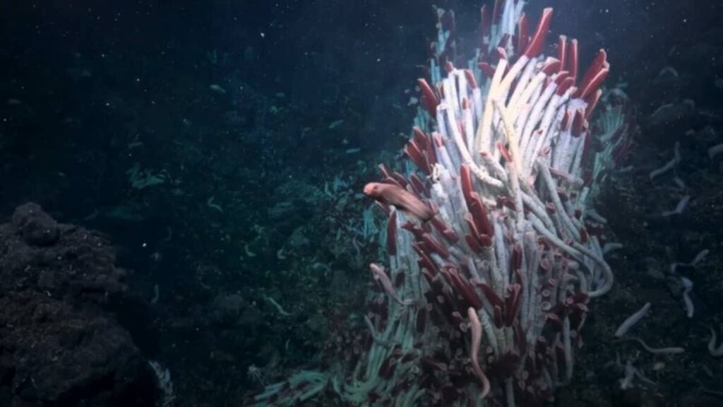
Recently, a group of researchers aboard a vessel from the Schmidt Ocean Institute used an underwater robot to flip over volcanic crust plates in the depths of the Pacific Ocean.
The international team of researchers discovered subsurface fluid veins beneath the seabed of this well-studied site, revealing an entirely new world that was previously unknown.
“On land, we’ve long known about animals living in underground cavities, and in the ocean, animals living in sand and mud, but for the first time, scientists have sought out animals beneath hydrothermal vents,” says Jyotika Virmani, the executive director of the institute, in a publication.
“This truly extraordinary discovery of a new ecosystem, hidden beneath another ecosystem, provides further evidence that life exists in incredible places.”
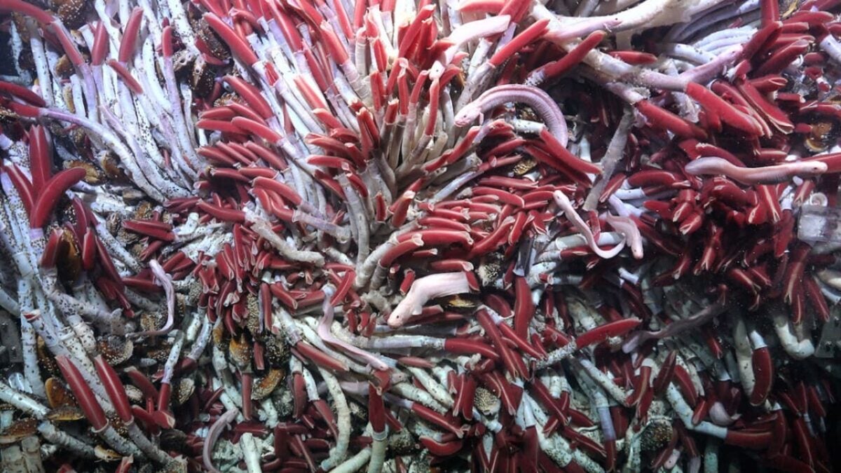
After removing the seafloor crust, a colorful ecosystem of worms, snails, and chemosynthetic bacteria that rely on minerals rather than sunlight for energy has been revealed.
“With this discovery, our understanding of animal life in deep-sea hydrothermal vents has been greatly expanded,” states Monika Bright, an ecologist from the University of Vienna, in the publication.
“There are two dynamic habitats at the vents. The animals above and below the surface vents thrive in unison, depending on the vent fluid from below and oxygen from seawater above.”
The researchers found tube-dwelling worms particularly fascinating, deep-sea creatures that appear to travel through volcanic fluids beneath the seafloor to colonize new habitats. This might explain why so few juveniles are seen congregating around deep volcanic fissures, as most could be maturing beneath the surface.
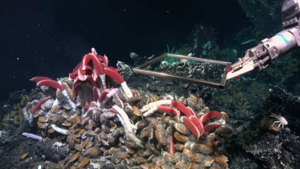
To test this hypothesis, researchers used a remotely operated vehicle, named SuBastian, to extract a square piece of ocean floor on the East Pacific Rise, located off Central America at a depth of about 2500 meters. The team then placed a mesh box over this lifeless spot.
When they retrieved the box a few days later, researchers discovered that a new group of animals had colonized the area. Scientists speculate that these creatures arrived from beneath the numerous cracks and fissures in the seafloor.
“The discoveries made on each Schmidt Ocean Institute expedition underscore the urgency of exploring our ocean depths thoroughly, so that we may understand what exists within the marine depths,” says Wendy Schmidt, President, and Co-Founder of the Schmidt Ocean Institute.
“The discovery of new creatures, landscapes, and now an entirely new ecosystem highlights how much we have yet to uncover about our ocean, and how crucial it is to protect what we still do not know or understand.”
Some of the links added in the article are part of affiliate campaigns and may represent benefits for Softonic.
A group of researchers has discovered the fossil remains of the oldest jellyfish species on record.
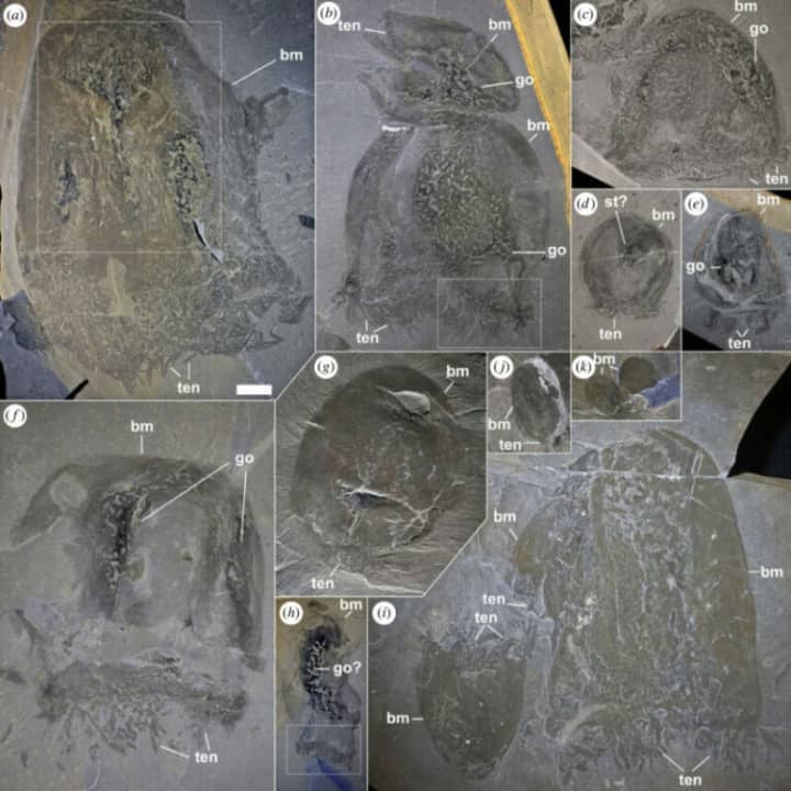
A group of researchers has discovered the oldest species of jellyfish recorded to date in fossils dating back505 million years. The fossils were found in the Burgess Shale, a region in Canada where previously, exceptionally well-preserved fossils have been unearthed.
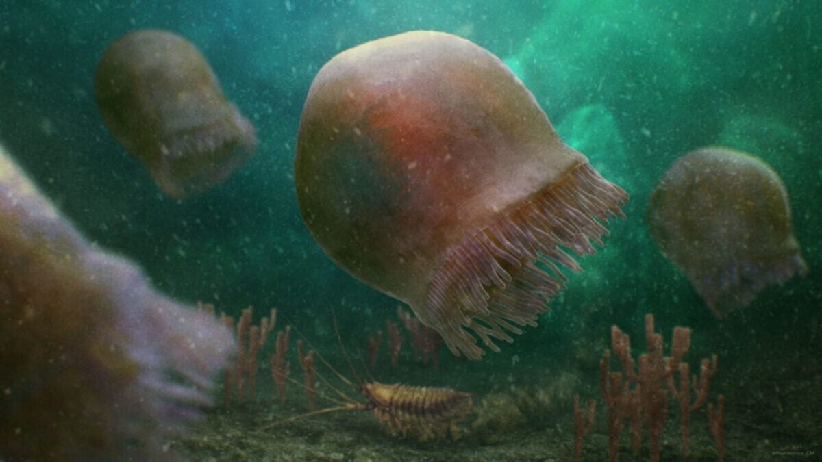
Dubbed as Burgessomedusa phasmiformis, this new species of jellyfish had a bell-shaped structure and measured about 20 centimeters in height. According to the study published in the journal Proceedings of the Royal Society B, the species had around 90 short tentacles that would have allowed it to capture relatively large prey.
“Finding such incredibly delicate animals preserved in rock layers on top of these mountains is such a wonderful discovery,” stated Dr. Jean-Bernard Caron, curator of invertebrate paleontology at the Royal Ontario Museum and co-author of the study.
Indeed, finding jellyfish fossils is an exceedingly rare event, regardless of their age. Approximately 95% of a jellyfish’s body is composed of water, and their remains easily decompose upon death, making the discovery of fossils from these creatures a challenging task. Nonetheless, a series of well-preserved fossils were found between the 1980s and 1990s.
With the discovery of this new species of jellyfish, researchers have been able to demonstrate that the food chain during the Cambrian period, the first period of the Paleozoic era, was much more complex than previously believed. “This discovery leaves no doubt that they were swimming around during that time,” affirms Joe Moysiuk, a paleontology student at the University of Toronto and co-author of the study.
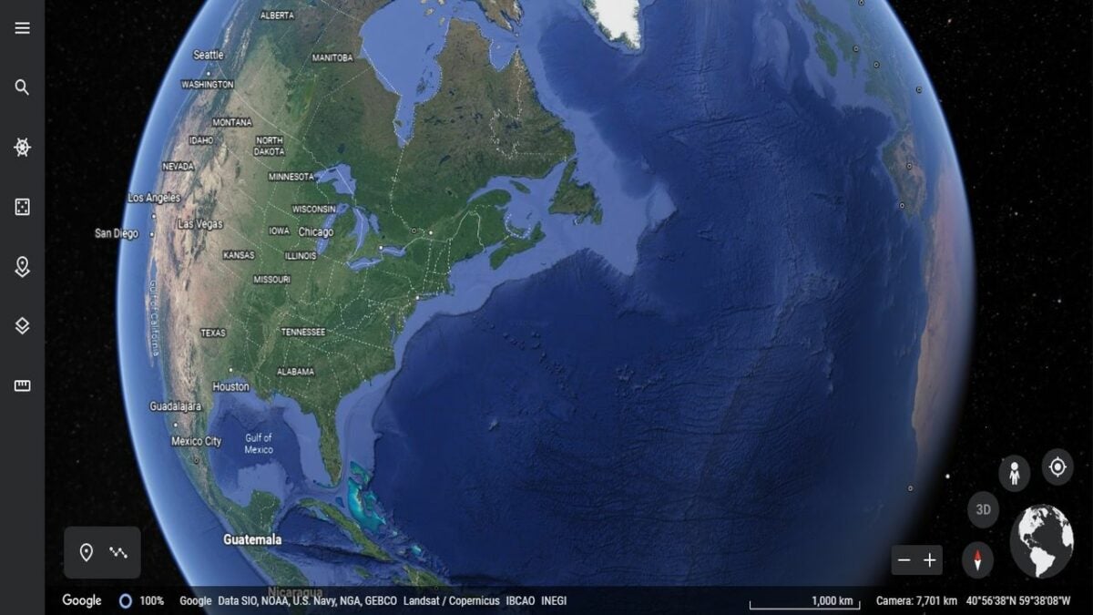
Navigating our world hasn’t been the same since the launch of Google Earth. Available in desktop and browser versions, the app has become more than just an interactive map. It’s evolved into a 4D spatial search engine that brings people together and fills their lives with wonder.
Google has been steadily improving and renovating the Earth service since its launch in 2001. Today, it’s almost hard to remember how anyone ever left the house without it. Here are a few of the most powerful and practical new things you can do with Google Earth.
Find out how a place has evolved over time
Google Earth’s satellite and aerial views let you take virtual trips around nearly any location on earth from many different angles. Over time, they’ve accumulated a lot of historical data from a lot of angles.
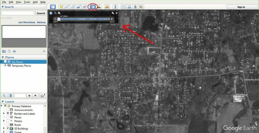
In recent years, the app has added a feature that lets you check out how a place has evolved over the decades. You can find this Time Travel tool in Google Earth’s desktop version.
Open the Google Earth app on your computer, and zoom into a location you’d like to view. In the toolbar above the main map window, look for a clock icon with a blue arrow pointing counterclockwise.
Click on the clock icon to display a slider labeled by year and month. Move that slider to the various available dates to see how that location looked in the satellite and aerial photos from that year.
Time travel in Street View mode
Besides the nearly 40 years of satellite and aircraft data it has access to, Google’s fleet of Street Viewcars have been taking pictures of city streets since 2007.
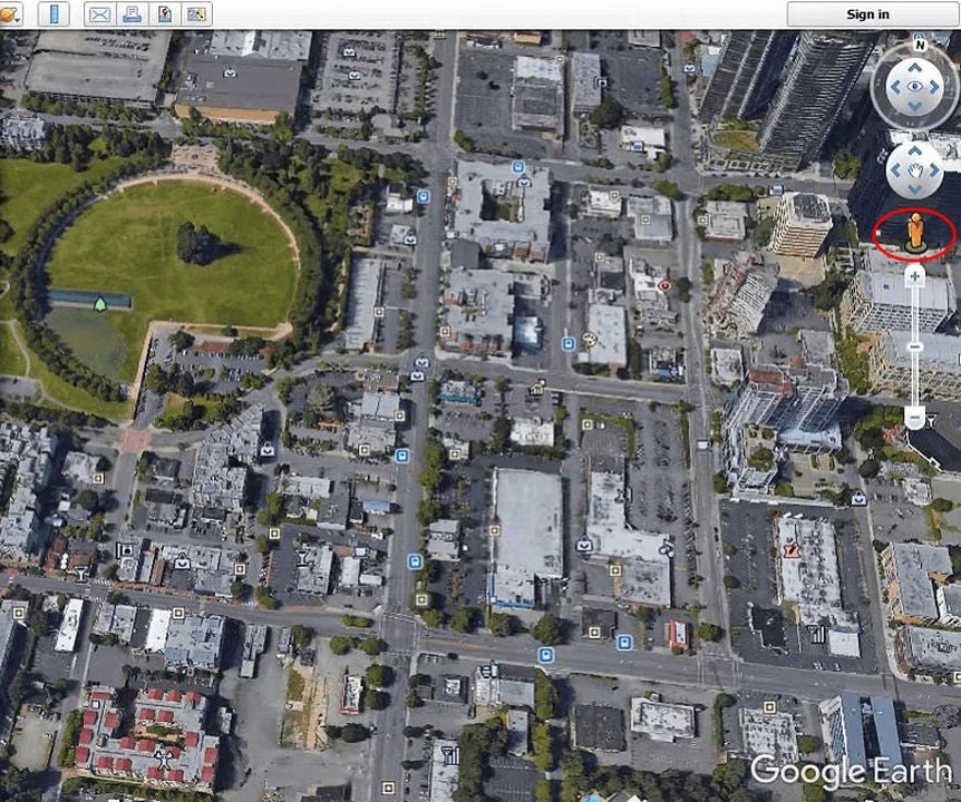
To time travel in Street Viewmode, go to your favorite location, and look for the little yellow human icon on the right.
Click on this “pegman” icon, and you’ll see the Earth areas with available street views highlighted in blue.
Drag the pegman to any blue highlighted area in the main map window to show that location in Street View.
Find the clock icon in the top toolbar again, and use the slider to see the photos that Google’s Street View cars have taken over the past years.
Watch an aerial time-lapse sequence
You can use Google Earth’s historical data to make an automatic aerial time lapse of any location on earth and then sit back and watch how it has developed over a given period. This tool lets you look at how cities have grown and natural features have changed throughout the decades since people started collecting data. You can even see time lapses in 3D from specific popular locations where lots of data is available.
Open Google Earth in your web browser, and find the location you want to see.
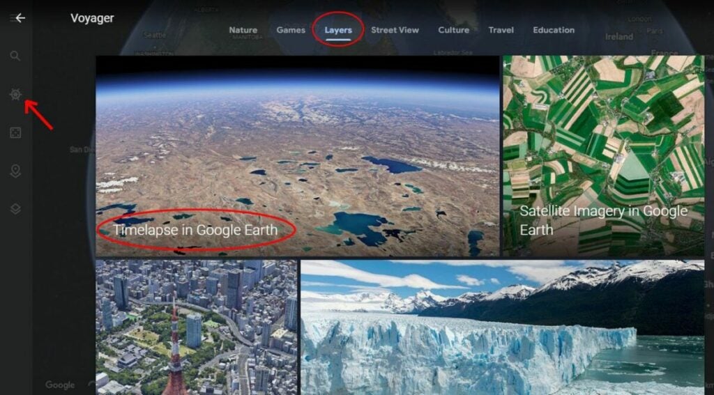
Click on the Voyager icon in the toolbar on the left. It looks like an old-timey steering wheel from the helm of a ship.
In the Voyager menu, click on theLayers tab at the bottom of the screen. Scroll down, and click on theTimelapse in the Google Earth layer.
The app will start loading data to run a time-lapse, which can take a few seconds. You’ll see the Timelapse menu open up on the right. You can use it to pause the time-lapse, set a specific range of dates, or choose a different location to view. You can also click on the 3D button at the bottom right of the main map window to change your view of the time-lapse.
Create and share your own Google Earth stories
The web version of Google Earth recently added the ability to create stories and share them with your friends.
In your browser, open Google Earth, and make sure you’re signed in to your Google account.
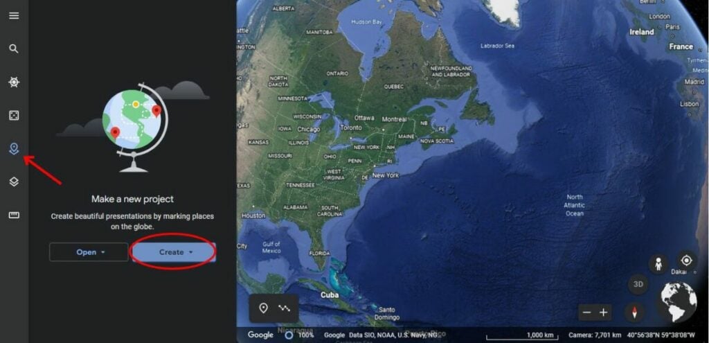
Click the Projects icon from the toolbar on the left. It looks like a location pin over a square.
In the Project panel window that appears, click on Create, and select Create project in Google Drive from the dropdown menu.
To add a location to your story, navigate the map or search for a place by clicking New feature in the Project panel window and then Search to add place.
Once you’re at the right place, click Add to project in the popup window or use the Add placemark tool at the bottom left of the map window, which looks like a location pin.
The places you add will appear in the lower half of the Project panel window. To edit their content, hover your mouse over a place and click the pencil icon. That will open a Property editor panel for that place where you can change your story’s default view of it or add customized photos, videos, and text.
If you want to check your work, click Preview presentation at the top of the Project panel window.
Google autosaves your work as you go. When you’re ready to share a story, click the Share button at the top of the Project panel window. It looks like an icon of a person next to a plus sign.
Use Google Earth to explore the globe like you’ve never seen it before
Google Earth is like a Swiss Army knife of exploration and discovery. It hasn’t added many new features recently, but the time-lapse and story creation tools it did add have given us new ways to look at the world like we’ve never seen it before.
Google Maps and Google Earth are edging closer and closer to becoming the same app. There is still a huge Google Earth feature missing from Google Maps though. One of the more lesser-known features of Google Earth Pro is the in-built hidden Flight Simulator. Accessible via the Tools Menu, the Flight Sim allows you to fly around the globe from a selected number of airports around the world.
This makes traveling the world using Google Earth a bit more interesting and fun than just panning it over with your mouse.
To access the Google flight simulator mode, go to the Tools menu and look for Enter Flight Simulator…
Step 2
You can then choose between two types of planes. Also, you can choose whether to fly from your current position in Google Earth or take-off from a selection of different airports.
Step 3
The controls for Google Earth Flight Simulator aren’t very clear. It isn’t as simple as pressing a start flight button. There is joystick support so you can use a Joystick if you’ve got one but if not, you’ll need to refer to this list of flight simulator keyboard controls. These keyboard shortcuts include the arrow keys, page up, ctrl, alt+a, and all manner of complicated keystroke and mouse controls. Note that they are different for Windows/Linux and Mac.
Step 4
The Head-Up Display is a standard basic HUD that displays altitude, heading, throttle, etc.
Step 5
It takes a while to master the basics, especially controlling thrust and altitude to prevent crashing. Once you have, it’s fun flying around and clicking on points of interest as if you were browsing Google Earth normally. You can even land your plane by throttling down when you approach an airport and pressing G to extend the landing gear. It’s quite hard as you need to control your flaps as well as hitting both “.” and “,” to break the left and right wheels.
For most people, the regular version of Google Earth is robust enough in terms of its feature set and rich imagery. So why bother with Google Earth Pro, Google’s supercharged, highly customizable version? The Pro version is an essential tool for land developers, city workers, and others who need to create highly customized maps.
But even if you’re not a real estate developer, there are some neat features in Google Earth Pro that don’t exist on Google Earth or Google Maps. Check them out and see if you want to try it for yourself. Here’s a bonus: it’s free!
Create your own customized maps
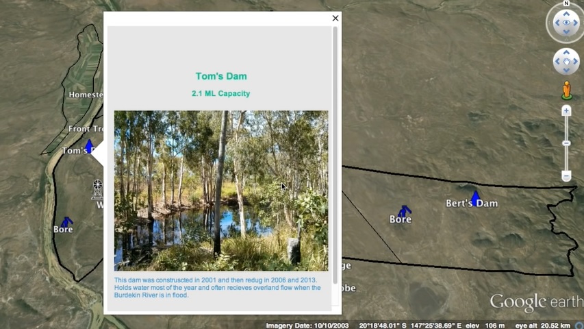
Google Earth Pro lets you create customized maps with a lot of extras. Not only can you draw lines and define areas on your map, but you can also add images and other types of files that represent different areas or points. So when you scroll over a point on your customized map, you can display multiple images, media files or other types of content.
Source: Google Earth Pro
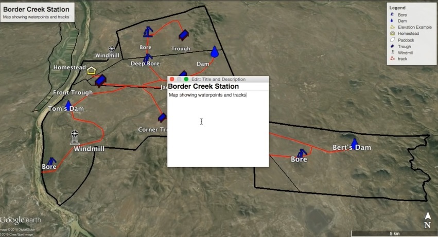
You can also add roads, pipelines, and paths to your map. A legend at the top right of the screen helps readers of the map understand what each graphic and line means. When you’re done creating your map, you can easily share the map with others via email.
Source: Google Earth
Measure land easily
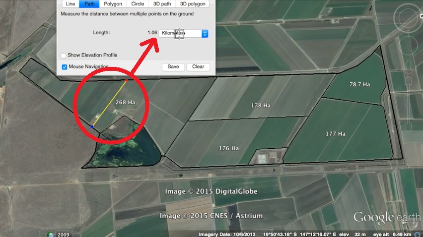
Don’t bother going out with a tape measure to measure the size of a patch of land; simply use the Google Earth Pro measuring tool. Draw a line from one point to another and see the distance between the two points, or draw any shape on your map to find the dimensions. This is especially helpful if you are buying land or planning a project.
Source: Google Earth
See plot plans and tenures
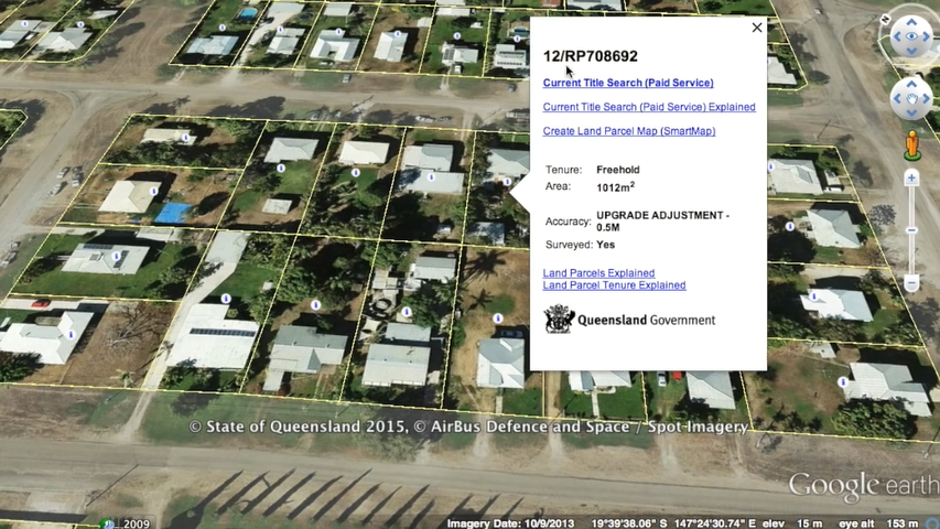
Google Earth Pro pulls information from databases all over the world to give you access to very detailed information on land ownership – plot plans, tenures, plot areas, and more. So if you’ve ever wondered about the history and ownership of that haunted house down the street, now’s your chance to find out! Just zoom into the desired area to access more detailed information about a location.
Source: Google Earth
Add more info to Google Earth for your convenience
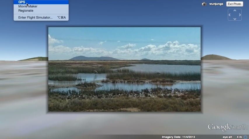
There’s a wealth of other information you can add to your maps, perhaps the most useful of which is GPS data. The GPS function may be especially handy if you want to capture hiking or walking trails that are not shown on the map. You can import waypoints, track routes, and adjust altitudes to ground height if you wish.
Source: Google Earth
Use the elevation tool to plan hikes
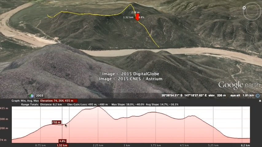
Speaking of hikes… Let’s say you’re planning on taking a hike and don’t want to sign up for more climbing than you can handle. Or maybe you are looking at land and want to know if it is low enough to be a flood risk. These would be good uses for the Google Earth Pro elevation tool. As you can see in the image below, you can view the elevation across a defined line.
Source: Google Earth
So what do you think? Are you enough of a map nerd to try out the Pro version, or will you stick with the regular Google Earth? Tell us in the comments.